CloudStudio helps survey and mobile scanning teams move from raw capture to shareable web viewing faster. Publish LAS, scanner projects, and 3DGS scenes with a workflow designed for real project delivery, not just demo playback.
Keep the homepage operational: upload source data, watch conversion state, and open the published scene without leaving the platform.
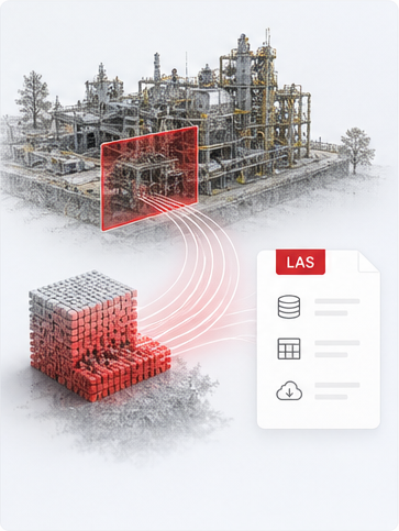
Drop a LAS/LAZ file or a full scanner project — CloudStudio prepares a streaming-ready scene and a shareable browser link.
No logs yet
From ingest to analysis to export — every step engineered for survey workflows.
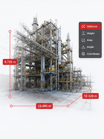
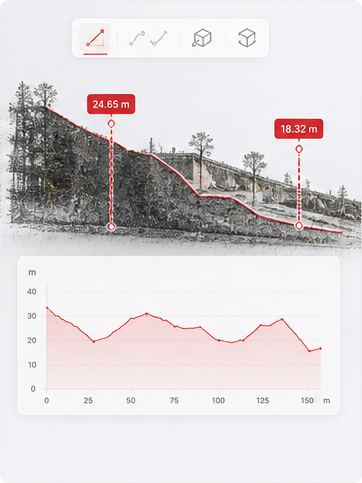
Distance, height, area, angle and point coordinates — with custom CRS and global unit switching, results read out in real time.
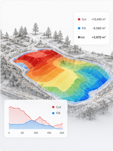
Polygon selection with 2.5D grid integration, gap-aware sampling, auto-recommended parameters, and cut/fill colour visualisation.
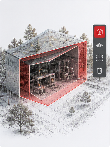
Box clip, polygon delete regions, and cross-section profiles — multi-layer deletion stays in sync with the backend on export.
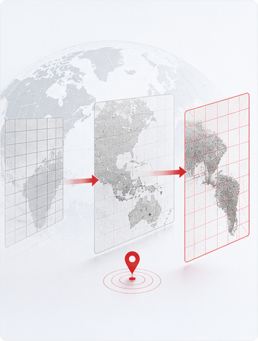
Built-in WGS84, UTM and Web Mercator. Custom EPSG/PROJ/WKT, plus support for .prj / .gsb / .tif parameter files.
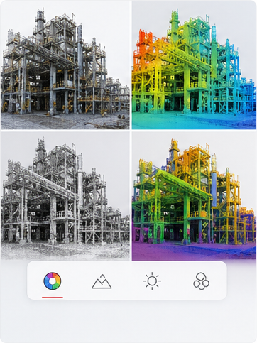
RGB, elevation, intensity, classification and LOD colouring; EDL eye-dome lighting and an X-Ray transparency mode.
Run measurements directly inside section views, switch backgrounds for clarity, and annotate with live dimensions.
Coordinates rewritten to true CRS metadata. Deleted regions propagate to the backend so what ships is what was reviewed.
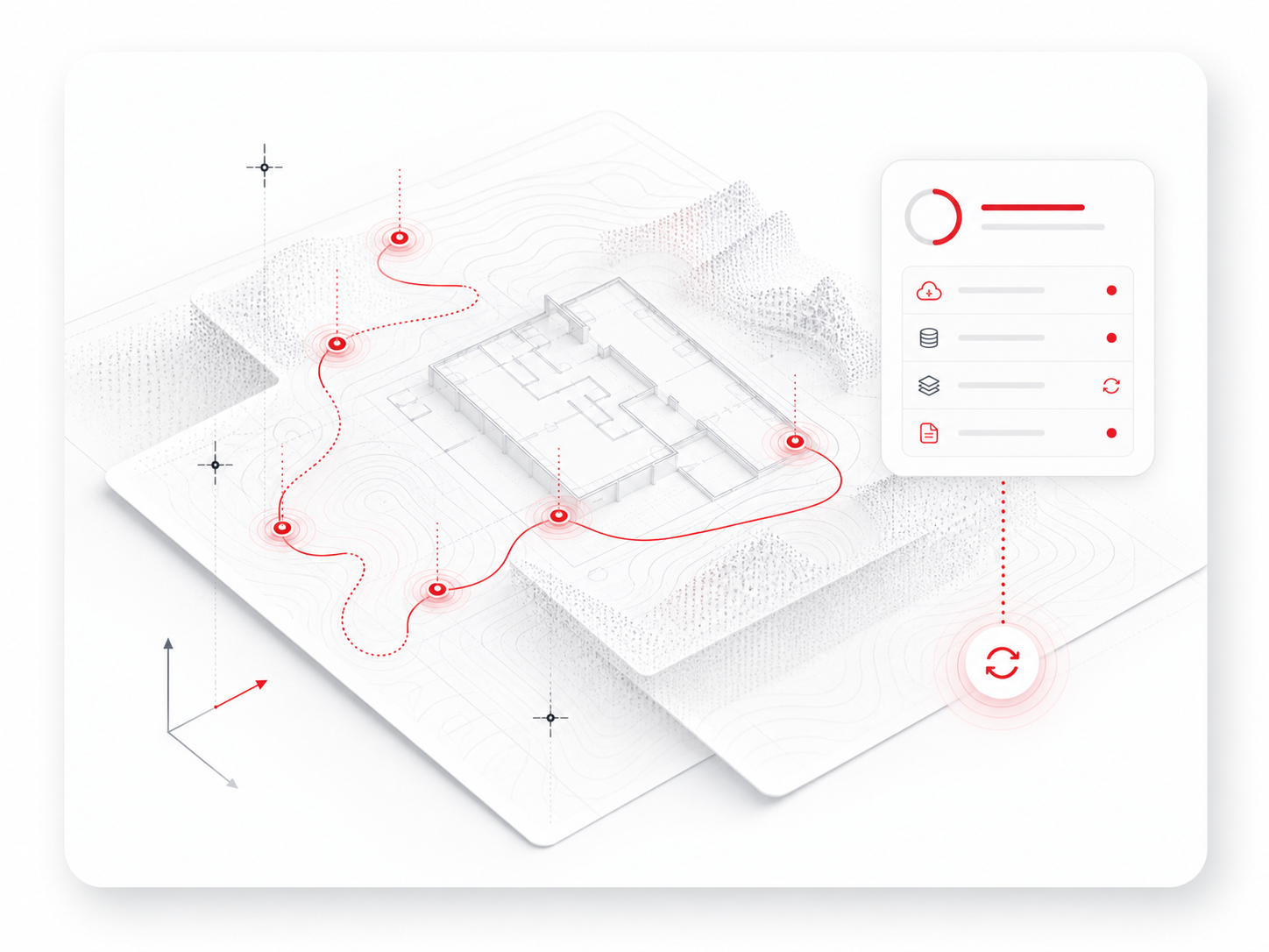
Auto-discovers scanner projects, parses geo_info.csv coordinate files, and loads full-site data with trajectories in one click.
A cloud-native 3D platform built for survey, construction, and inspection teams who can’t afford to wait on a desktop install.
Deploy CloudStudio on your own infrastructure in minutes, or run it managed. Encrypted transit, scoped access, multi-project isolation — built for teams that take governance seriously.
A floating-origin pipeline sidesteps the precision walls that plague WebGL viewers. Measurements stay rock-steady at planetary coordinates; overlays and clipping never drift.
Stakeholders open scenes in any modern browser — no client software, no plugins, no GPU workstation required. Engineers and reviewers see the same thing, instantly.